
Road Map
From the Collection
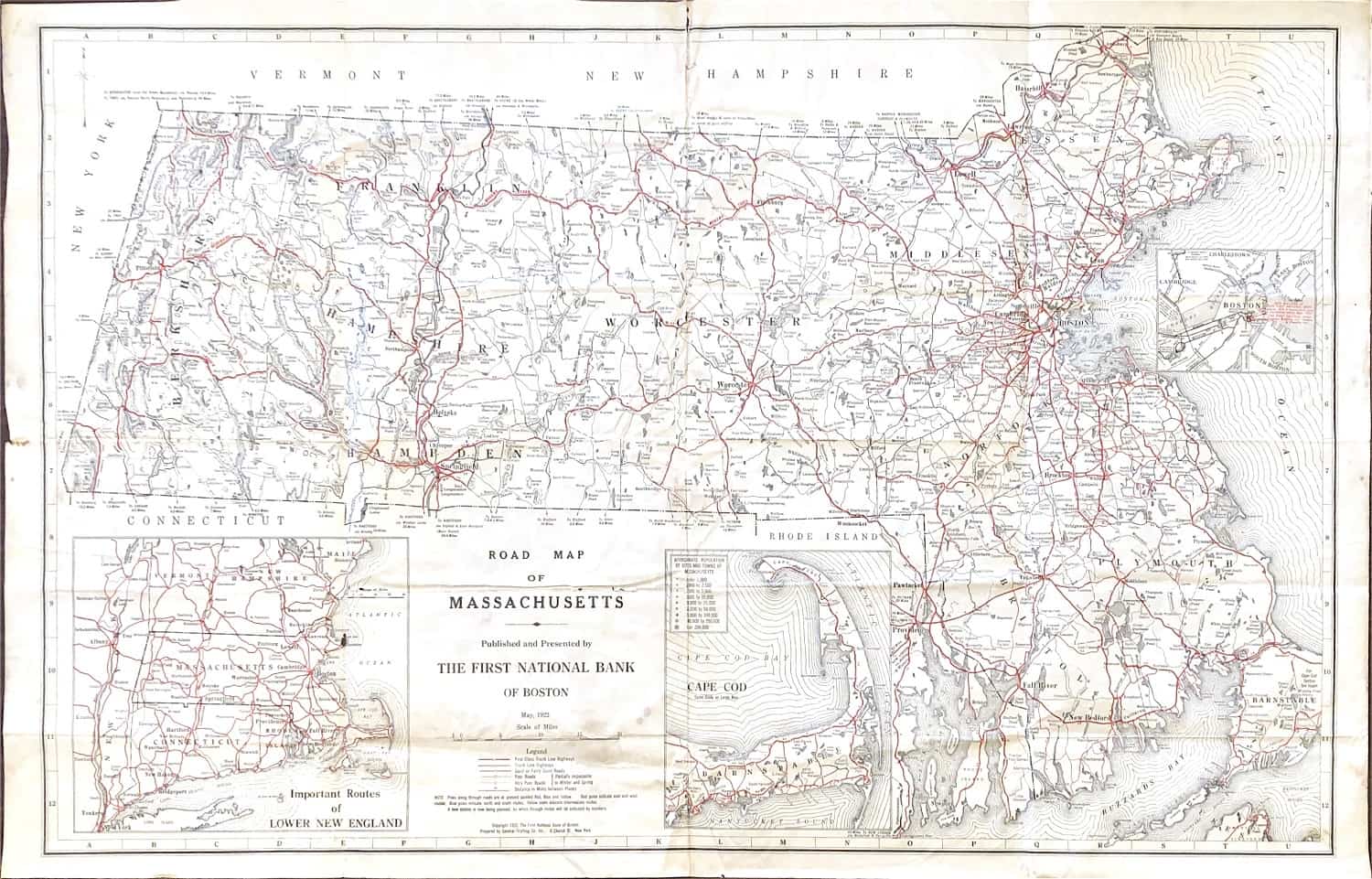
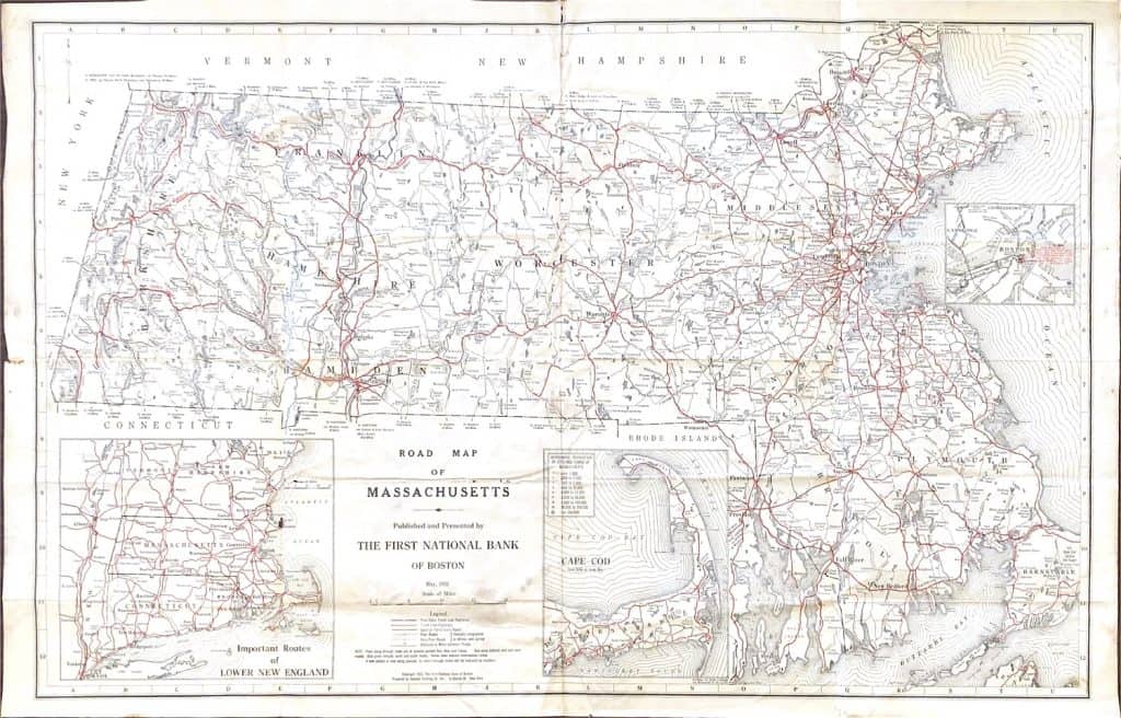
Road map of Massachusetts, as it looked 100 years ago, 1922. It was published by the First National Bank of Boston. Cape Cod, Boston, and the overall “Lower New England Region” were highlighted in their own blocks. Road quality was a major highlight, such as impassibility during the winter. The road system was reminiscent to today. Route 3, as it exists now, was not in use until 1927. According to the Westford Gazetteer, the Route did not run through Westford until the 1950s, the road largely following what is today called Route 3A. I-495 was called “New Route 110” in 1958, but changed to “Interstate 495” in the same year. It is one of the Blue Star Memorial Highways that commemorate the US Armed Forces. 495, through Westford, was not in use until 1961.
W.1998.7.2a